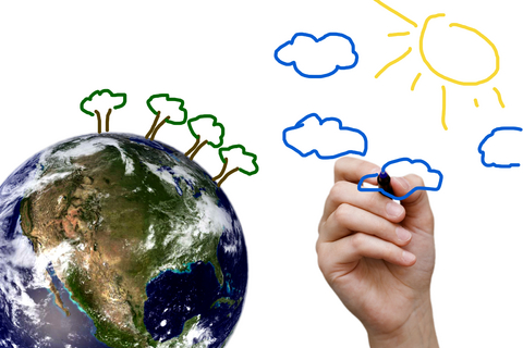
Children bouncing around looking for summer activities? Preschoolers are at a stage where they start to process more information about the world around them. Much the same way I add carrots and beets to smoothies, I like to suggest delicious and nutritious activities that might stimulate the mind without my children noticing much. For 3 – 6 year old children, I suggest simple mapmaking activities. You can create a multi-step, multi-sensory activity that gets children thinking about the world around them. I like this as a summer activity because it has the potential to spark the kind of interest that can turn into a ongoing project. This could keep them engaged for the summer like Wesley’s project in Weslandia.
Importance of Geography
When I read the sad stories of the geographic ignorance of students who weren’t sure how the world around them fit together, I knew that wouldn’t be my homeschooled children. Geography and social geography have been important themes for us since my children were very young. Over that time, I have collected a lot of great resources for geography and mapmaking for a variety of ages.
By far my favorite book for children is David Sobel’s Mapmaking with Children: Sense of Place Education for the Elementary Years. If you only go this far in the post, look up this book.
I Am Here!
Young childhood is a stage of curiosity and exploring but still with a focus on self. We can use that to encourage self exploration or close-to-home exploration.
Starting with models built with blocks or Playmobil or other toys, encourage your child to create a model of your house or yard. Starting with moveable objects allows the creation to be a conversation between you. This also puts the tools of creation in your child’s hands if she decides to create her own models some other time.
Then, bring out the crayons and paper. Without giving too much guidance how to do it, ask your child to draw a path through your house or your yard. By suggesting drawing a path, you don’t run into the issue of explaining what a map is—yet. Some children will draw a view from above as we usually think of maps, while others may draw from other directions. Give your child space to be creative.
- Show the path you take in the morning when you get up
- Show the path the dog takes when he runs into the yard
- Show the path from you room to your bike
- Show where each person in the family sleeps
- Show all of your favorite spots in the yard
If your child is a little bit older and more interested in life beyond home, try applying the activity to a map of the neighborhood.
Sobel shows in Mapmaking for Children that developmentally appropriate mapmaking for children progresses through scope (home > neighborhood > community > nation) as well as through methods of representation (models > pictures > panoramas > contour and aerial maps). The more open you make your request, the more naturally your child can move through the stages of thinking about and representing the world.
Earlier this year, my son started a week long neighborhood mapping project. We used overlays so he could draw the houses once then add new, separate elements each day. Each day, he decided what new information to add. Day one, he drew houses in relation to one another from above. Day two, he added the names of neighbors. Day three, he added where children live and their names. Day four, he added trees. Day five, I wanted to encourage him to use other senses. I asked him to add sound to the map, so he walked through the neighborhood and listened for dogs barking at him then he added dogs (and their names) to the next layer. In the end, he created an interesting aerial and aural view of our neighborhood.
Mapmaking Resources for Children
If you can interest your children in place, you can use maps and geography as a starting point for a lot of other learning. Because I like scattering interesting baubles along the path and waiting to see which my children pick up, I have a lot of books on maps, history of maps, geography, children of the world, junior maps, 3-D maps, and more and more maps. And, we frequently fly around the world using Google Earth.
In addition to Sobel’s book above, my favorite resources for geography with children are the National Geographic Society’s Expeditions project, which includes lesson plans by age and by geography standard, and Mapping the World by Heart, which includes one award-winning teacher’s lesson plans for geography. Both have projects that can be adapted for age and interest.
Have a wonderful time exploring with your preschooler. If this isn’t the project of the summer, scatter more baubles and see what he picks up.
Image © Mario Lopes | Dreamstime.com
